Understanding what happened on Lexington Common on 19 April 1775 is arguably impossible without a good map of the field. Who could see what? Where were the roads and the stone walls and the houses referenced by witnesses?
Fortunately, enough information and physical evidence exists to reconstruct a convincing layout.
Building a Map in Three Steps
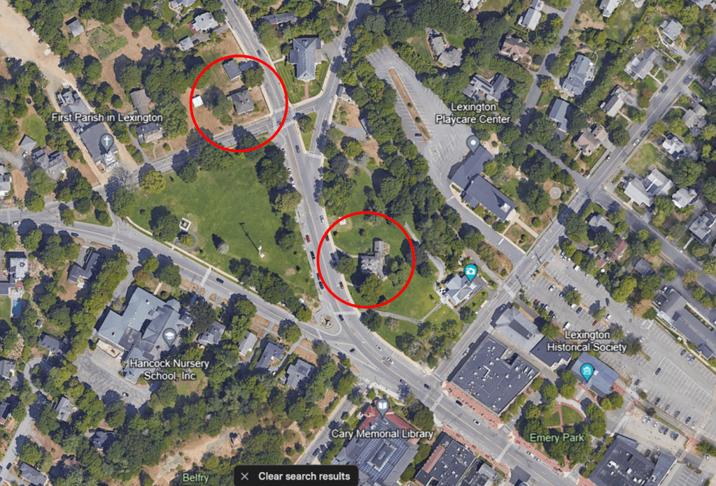
Google Earth provides the basic dimensions for the green. Jonathan Harrington’s house and Buckman Tavern still stand, supposedly in the same location as they did in 1775.
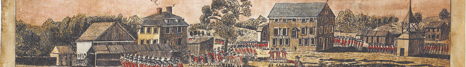
Ralph Earl’s famous sketch provides the layout of Buckman’s sheds and barn, as well as the meetinghouse and several other structures.
The perspective appears to be from Jonathan Harrington’s upstairs window. Since that building is one of the two still standing and the other–Buckman Tavern–is in view, we can use line of sight to place the structures around the common with some degree of accuracy.
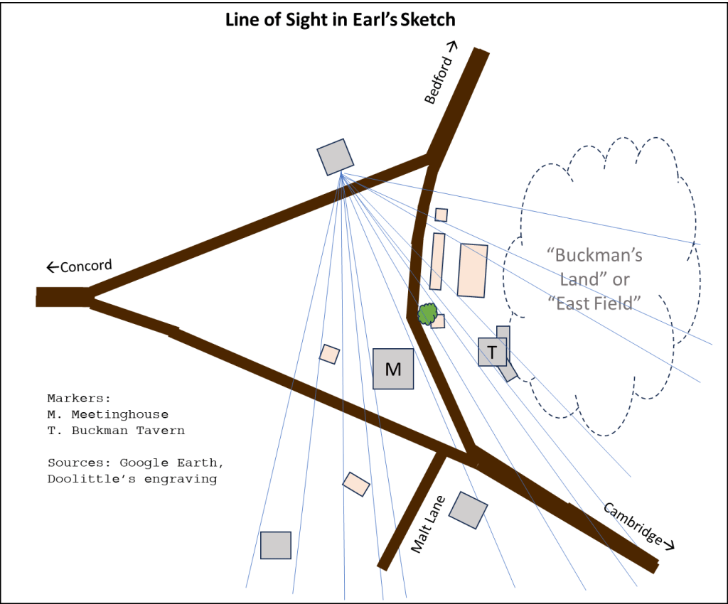
We can place other buildings using Hudson’s 1868 map and Canavan’s description of the common, including the absence of today’s Bedford Street in 1775. Levi Harrington’s 1846 account includes the location of Jonathan Harrington’s barn and Viles Shoe Manufactory.
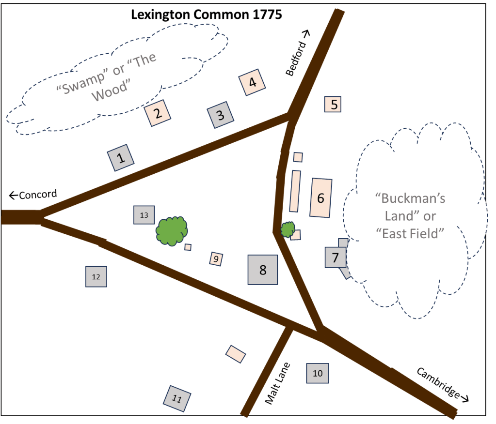
The structures on the map shown above:
- Daniel Harrington’s House
- Daniel Harrington’s Workshop
- Jonathan Harrington’s House
- Jonathan Harrington’s Barn
- Viles Shoe Manufactory
- Buckman’s Barn and Cow Sheds
- Buckman Tavern
- Meetinghouse
- Belfry
- Wm. Munroe Blacksmith’s House
- Malt House
- Marrett Munroe’s House
- Schoolhouse
From here, we can start adding soldiers. See the Full Story for a step-by-step reconstruction of the fight.
